
Whether you're backpacking or day hiking, snowshoeing or Nordic skiing, Paradise in Mount Rainier National Park is one of the most beautiful destinations to visit in Washington State during winter, with hundreds of people lining up every morning for the opening of the gate to Paradise.
Everett and I decided to kick off the end of 2022 and start off the new year with a backpacking trip on Mazama Ridge in Paradise, for what ended up being one of the most physically demanding but most breath-taking backpacking trips that we've ever embarked on. On a blue bird day, snowshoeing through Mazama Ridge offers some of the most spectacular views of Mount Rainier and its surrounding mountains. What an amazing way to kick off 2023!
Contents
Adventure Stats
Hiked on: December 31, 2022 - January 1, 2023
Hike Time: 1.5hrs Day 1 / 4.5hrs Day 2
Camped at: Mazama Ridge
Weather: 33F/16F cloudy / sunny
Popularity: Low
Route Finding: Difficult, off trail navigation skills and tools required between 4th crossing and Inspiration Saddle
Trail Hazards: Deep snow, creek crossings, avalanche prone territory
Key Sights: Snow, mountains, forest
Gear Recommendations: Snowshoes required
The Route
Distance: 5.65mi mapped (7mi tracked)
Elevation: +1109ft
Location: Mount Rainier National Park
Direct Link to Trailhead: Google Maps
Direct Link to Route: Caltopo
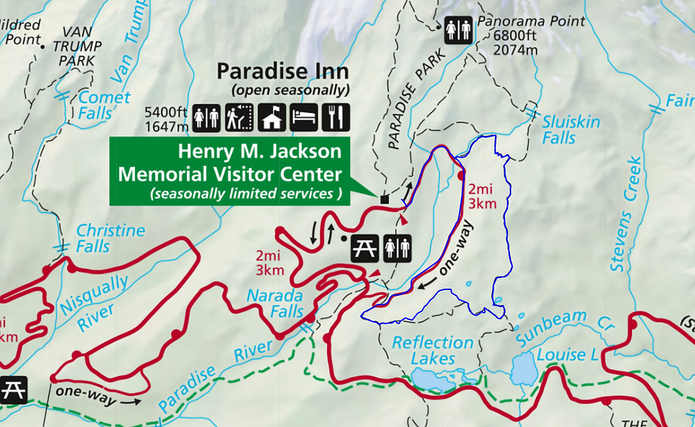
The route above is the route that we ended up taking. We had originally wanted to take the Lower Lakes Trail back to Paradise, but we had misdrawn the intersection of the route with the Lower Lakes Trail and couldn't find the Paradise River crossing. Instead, we ended up taking the Paradise River Road back, which is about a mile longer and much less steep.
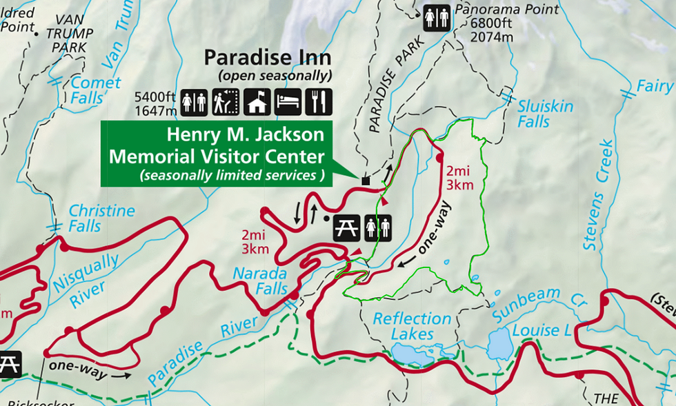
After re-observing the junction at the trailhead, we believe that the route marked in green below is where you can take the Lower Lakes trail back. Proceed at your own risk as I have not tried or vetted this route. The Caltopo map I have linked above has both routes available for off-trail download so that you can choose your own adventure.

Trail Report
Before you begin your epic adventure, please be advised that the Paradise area of Mount Rainier National Park is only open on weekends for the 2022/2023 season.
The day before we began our trip, we made sure to acquire a bear canister. Most national parks in the Pacific Northwest do not require bear canisters during winter, as most bears and other hungry critters hibernate during this time. In fact, parts of Mount Rainier National Park other than the Paradise area of Mount Rainier do not require bear canisters either. However, due to the popularity of backpackers in the Paradise area, rangers at Mount Rainier National Park have discovered that foxes will still find their way into backpackers' food during wintertime. If you don't own a bear canister, many REIs still rent bear canisters this time of year.
We arrived at Longmire at around 9:30am on Saturday morning and quickly obtained our backpacking permit at the Longmire Museum. Kudos to the ranger that was issuing permits that morning! Despite the staff shortages at Mount Rainier National Park, the ranger that issued our permit was incredibly friendly and helpful. During wintertime, backpacking permits only need to be displayed at your camp rather than be present on your bag the whole time you hike.
In case you forget to pack WAG bags or bear canisters, you can pick them up from the Longmire Museum when you snag your permit. However, because of how bulky bear canisters can be, I recommend that you acquire one the day before.
Because it was New Year's Eve, the parking lot at Longmire was crowded but not packed as park visitors excitedly waited for the gate to Paradise to open. Other backpacking groups carried champagne with them -- an idea that we'll have to save for next year!
The road to Paradise had opened at 10:00am that morning, but often opens as early as 9:00am in the winter. For the latest information on when the gate to Paradise will open, be sure to follow @MountRainierNPS on Twitter.
The downhill road out of Paradise closes at 4:00pm, so be mindful of how much time you budget for your second day.

We got on the road to Paradise right when it opened. The roads were plowed but not scraped nor salted. We found that chains were necessary for a safe drive up, and there were a couple of designated chain-up pulloffs along the road. For reference, we drove a 2WD Toyota Corolla.
For our drive down on Sunday around 3:00pm after a very sunny day, the road was snow free.

There's a designated lot for overnight parking, marked in green on the visitor center map attached. Please be sure to park in this parking lot if you're backpacking to maximize the availability of parking near the visitor center for day-visitors and to ensure that your car doesn't get in the way of snow plows clearing the road overnight.
Snow-depth at the trailhead was about 3ft high, and we put our snowshoes on right at the trailhead. Because the road to Paradise at Mount Rainier is only open on weekends for the 2022/2023 season, trails will likely be hidden under snow mid-week. We were lucky enough to have a section of the trail partway up to Mazama Ridge already broken by those who were able to get their snowshoes on quicker than us!

Fourth Crossing was marked on either side with black poles to ensure that hikers, snowshoers, and Nordic skiers find their way across the bridge rather than through Paradise River.
Immediately after Fourth Crossing, the clockwise loop to Mazama Ridge branches off to the left. We found this bit of the trail to be especially exhausting since it's one of the steepest sections.
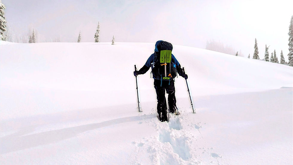
Partway up to Mazama Ridge, we passed the group that was trail-breaking the snowshoe route, and Everett began to lead the caravan for the final push up to Mazama Ridge. Even with snowshoes on, we still sunk a foot deep into the snow. Due to the steepness of this section, cutting switchbacks through the virgin snow was crucial for reaching the top.
Shortly after we reached Mazama Ridge, we separated from the other group to find a spot to set up camp. All camp locations in Mount Rainier National Park are recommended to be 300ft away from the primary trail. We followed good winter-camping practice and found a nice spot sheltered from the wind.
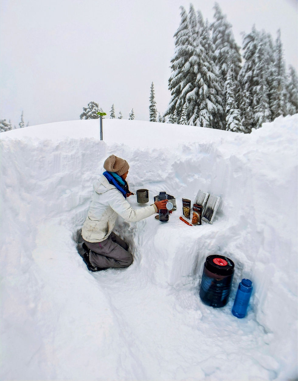
It had only taken us an hour and a half to get from the trailhead to where we had set up camp. We spent the next couple of hours setting up camp, digging out a dining room in the snow, and enjoying dinner.
By 4pm, the sun had set. We tucked into our tent for a nap and awoke shortly after midnight due to Everett's sleeping pad springing a leak.
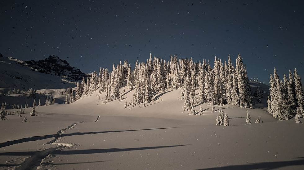
Outside our tent, we found the sky clear for the first time in the last 10 days and got gorgeous moonlit views of Mount Rainier and the surrounding landscape. We spent the first hour of the new year basking in the beauty of the starry sky.
We slept through the rest of the night with no substantial wind or snowfall.

Sunrise the next morning at 8am was unparalleled with the sun casting a soft golden glow across the whole ridge, turning Mount Rainier a rosy pink, then gold, and finally white.
As we began our hike that morning, we quickly realized that yesterday's snowshoers did not venture much further than the junction, where we branched off to find camp.

For the entire Mazama Ridge snowshoe trail, we had to forge our own route through the snow. Good off-trail navigation was critical for us to stay on course and avoid avalanche-prone terrain nearby.

We did find ourselves off-course and forging trails through trees occasionally. We also found ourselves briefly snowshoeing through a steeper section of trail that was prone to more avalanche risk but quickly navigated to flatter ground.
There was a seasonal creek crossing hidden beneath the snow shortly after the junction that branches off toward Faraway Rock. This creek crossing was a steep valley in the snow. We couldn't find the official location to cross and instead took the flattest section we could find. Due to the snow depth this time of year, there was little risk of falling through, but I'd be wary for anyone attempting this route during spring.

We were incredibly happy to finally link back up with pre-formed trails just before meeting the junction at Inspiration Saddle, where we finally met other snowshoers for the first time all day.
We linked up to Paradise River Road not too long after. The route we had intended to take took the Lower Lakes Trail back to Paradise. However, due to an error in the way we had mapped the junction to the Lower Lakes trail, we were unable to find the junction in the moment. Instead, we followed other snowshoers and Nordic skiers up Paradise River Road, which added an extra mile to our journey.
Closing Thoughts - 10/10
Backpacking through Mazama Ridge was the best way I could have possibly started off 2023. I was lucky enough to catch it on a perfectly clear day with the views of Mount Rainier and its surrounding mountain ranges absolutely unparalleled.
For future snowshoers, be sure to budget appropriate time. We found that through trail breaking and route finding, we were only traveling at .5mph versus 1.5mph on already broken trails. We felt quite a bit of time-pressure so that we could leave Paradise before the gates closed at 4:00pm.
Other Resources
Looking for additional information to have a safe trip?
Here's Mount Rainier National Park's guidance on how to plan a winter camping trip in the park.
You can find other trail reports on Washington Trails Association and AllTrails. Please note that AllTrails receives much fewer trail reports in the winter months and is generally much less detailed.


Comments